A chart is a grid. Latitude lines (parallels) run east–west and are numbered north or south of the equator, 0° to 90°. Longitude lines (meridians) run north–south and are numbered east or west of the Greenwich meridian, 0° to 180°. Every position is a pair of these numbers, and every distance you measure on the chart is taken from the latitude scale. That is the whole guide; the rest is technique.
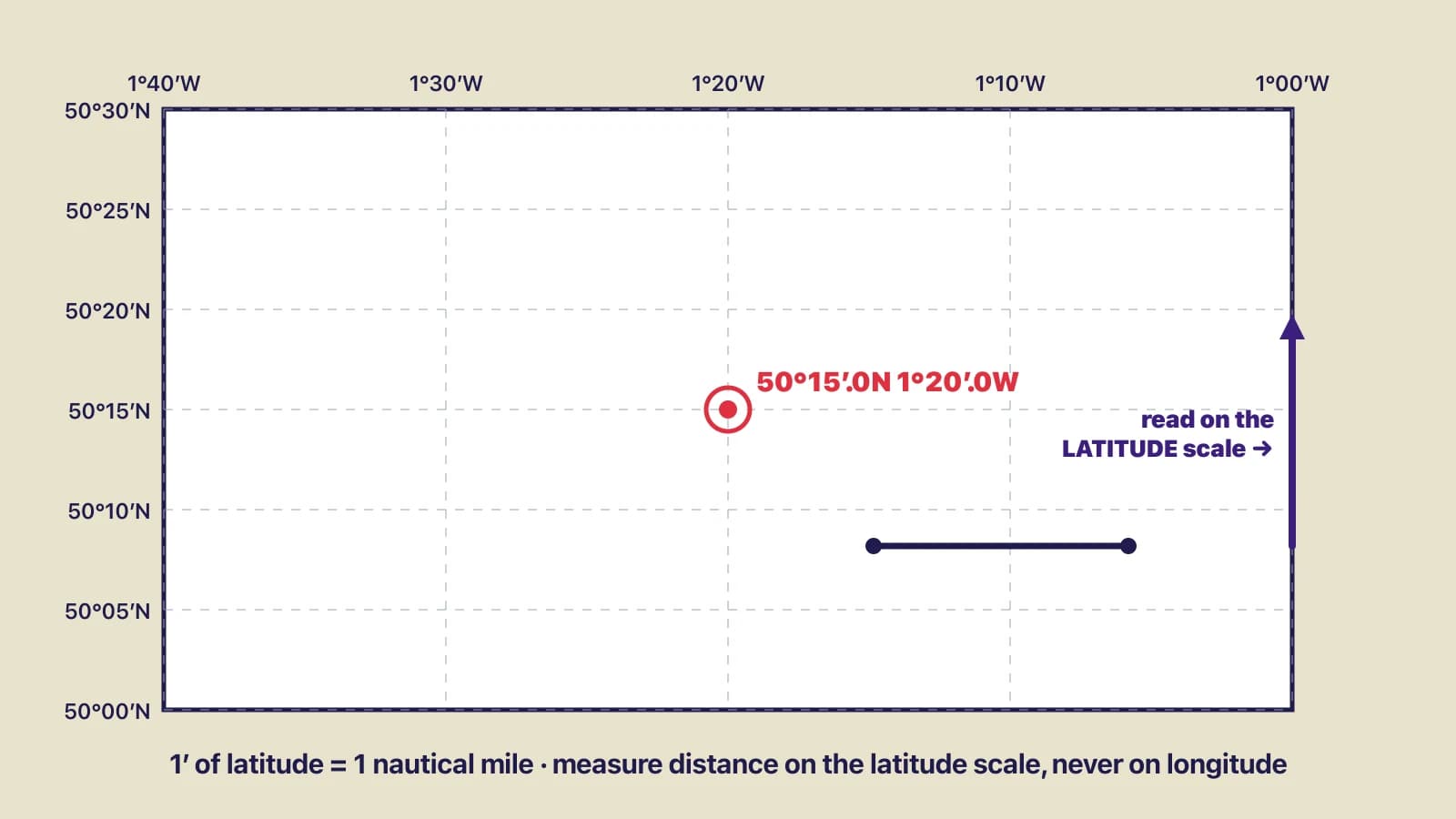
A chart rectangle with latitude and longitude scales, a plotted position and dividers being measured on the latitude scale.
Writing a position
Latitude first, longitude second: 50°45′.6N 001°17′.2W. Degrees, then minutes to one decimal place (a tenth of a minute is about 185 m, which is precise enough for most coastal work), then the hemisphere letter. Longitude is usually written with three digits of degrees so that it cannot be confused with latitude. Say it aloud the same way: “fifty degrees forty-five decimal six north, zero zero one degrees seventeen decimal two west”. When you read a position off a GPS, check that the unit is set to degrees and decimal minutes, not degrees-minutes-seconds or decimal degrees, because a GPS showing 50°45′36″ and a chart labelled in decimal minutes will lead to a plotting error of several hundred metres if you copy the digits across.
Plotting a position
- Find the latitude on the side scale nearest to where the position will fall. Set the dividers or lay the plotter's edge from that graduation.
- Draw, or hold, a short east–west line at that latitude across the area of the chart you need.
- Find the longitude on the top or bottom scale and bring it down or up to cross that line, using the plotter or a parallel rule aligned with the meridians.
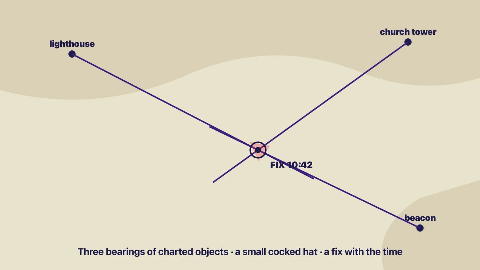
- Mark the crossing with a dot and the fix symbol (a circle for a fix, a triangle for an estimated position), and write the time beside it.
Taking a position off the chart is the reverse: lay the plotter through the point parallel to the parallels and read the latitude where it meets the side scale, then parallel to the meridians to read the longitude on the top or bottom scale.
Measuring distance
Set the dividers to the two ends of the distance you want, then, without changing them, hold them against the latitude scale at the same latitude as the middle of the line you measured, and count the minutes: minutes of latitude are nautical miles, tenths of a minute are cables (a cable is a tenth of a mile, about 185 m). For a long line, step the dividers along it in fixed steps — say five miles — set from the scale at the appropriate latitude, and count the steps.
The latitude scale must be read level with the line because of the chart's projection. On a Mercator chart, the projection used for almost all coastal charts, the scale of latitude stretches as you go towards the poles, so a minute of latitude near the top of a chart of the English Channel is drawn slightly longer than one near the bottom. The chart's own latitude scale, read at the right latitude, allows for this. The longitude scale does not: a minute of longitude is a mile only at the equator and about 0.6 of a mile at 50°N, which is why using it for distance produces answers that are wrong by a large and variable amount.
Units you will meet
| Unit | Definition | Use |
|---|---|---|
| Nautical mile (M or NM) | 1,852 m exactly; ≈ 1 minute of latitude | All chart distances |
| Cable | One tenth of a nautical mile, ≈ 185 m | Short distances, harbour work |
| Knot | One nautical mile per hour | Speed through the water, over the ground, and of tidal streams |
| Metre | Depths, heights of tide, drying heights and clearances on metric charts | Vertical measurements; not horizontal distance |
The common mistake
Measuring a distance against the longitude scale, or against the latitude scale at the wrong latitude on a large chart. The second is a small error; the first is a large one. A quick sanity check: at 50°N a minute of longitude is about six tenths of a mile, so if a north–south distance and an east–west distance that look the same on the chart give you different mileages, you have used the wrong scale for one of them.
Check yourselfYour dividers span a passage on the chart. Held against the latitude scale at the passage's latitude they cover 7 minutes and about 4 tenths. How far is the passage, and how long will it take at 5 knots through the water with no tide?Show answer
7.4 nautical miles. At 5 knots, time = distance ÷ speed = 7.4 ÷ 5 = 1.48 hours, about 1 hour 29 minutes. With a tidal stream the time over the ground would differ; see the guide on course to steer and estimated position.
Key takeaways
- Positions: latitude then longitude, degrees and decimal minutes, with N/S and E/W.
- One minute of latitude is one nautical mile (1,852 m); a tenth of a minute is a cable.
- Measure distance on the latitude scale, level with the line you are measuring. Never on the longitude scale.
- Check the GPS position format before copying digits onto the chart.